Blog Schedule

I post on Monday with an occasional random blog thrown in for good measure. I do my best to answer all comments via email and visit around on the days I post.

Tuesday, April 30, 2013

Z is for Zootenvaal Estate

For this, my fourth year doing the challenge, I've decided to share place names from the Virgin Islands. For such a small spot in the ocean, it seems like every rock, cove, hill and house has been christened. The names are a unique mix of Spanish, Danish, French, Dutch, English, and African to name a few.

Zootenval Estate, St. John A place to get away from it all. You can check out a video HERE.

Other Z Names:
 Zambee, St. Thomas A area up on Crown Mountain Road

My thanks to everyone who stopped by to take this little tour of the Virgin Islands. I hope you enjoyed your visit!

Monday, April 29, 2013

Y is Yacht Haven

For this, my fourth year doing the challenge, I've decided to share place names from the Virgin Islands. For such a small spot in the ocean, it seems like every rock, cove, hill and house has been christened. The names are a unique mix of Spanish, Danish, French, Dutch, English, and African to name a few.


Yacht Haven, St. Thomas
Back in the 1950s Yacht Haven mostly consisted of a labyrinth of narrow wooden finger piers and was home to many, many sailboats and houseboats. At the end of one of those piers was a palm thatched bar. It was a community with its fair share of characters. In 1995, a hotel that had been built was destroyed by  Hurricane Marilyn. Now it is a marina for the wealthy who have private yachts and simply must run to the Gucci store for a new purse.


Here's bit of conspicuous consumption. Notice it carries its own private helicopter.


Other Y names:
Yawzi Point Trail, St. John. There's a nice video of the trail and the swim at the end HERE. It can get hot on the trail so it's advised to bring water.

Saturday, April 27, 2013

X is for X Marks the Spot!

For this, my fourth year doing the challenge, I've decided to share place names from the Virgin Islands. For such a small spot in the ocean, it seems like every rock, cove, hill and house has been christened. The names are a unique mix of Spanish, Danish, French, Dutch, English, and African to name a few.


Marks
the Spot!
What with pirates roaming the area there are tales told of treasure, though I'm not sure any has ever been found. And then there's the story about a cay named Dead Chest in the BVI. The story goes that Blackbeard marooned several of his crew on the island with only a cutlass and bottle of rum each, leaving them to battle it out.  "Sixteen men on a dead man's chest, yo ho ho and a bottle of rum." Although I've never been able to verify it,  supposedly Robert Lewis Stevenson sailed through the islands, heard the story and was inspired to write, Treasure Island.

Here's my treasure map of St. John, with an X marking one place near and dear to my heart. Many of the places that I have featured or mention during the A to Z Challenge are on this map.


Friday, April 26, 2013

W is for Whistling Cay

For this, my fourth year doing the challenge, I've decided to share place names from the Virgin Islands. For such a small spot in the ocean, it seems like every rock, cove, hill and house has been christened. The names are a unique mix of Spanish, Danish, French, Dutch, English, and African to name a few.


Whistling Cay, St. John
Whistling Cay is on the north side of St. John just off Mary's Point. Two British islands are visible in this picture. To the left you can see a bit of Jost Van Dyke. To the right is Thatch Cay. There is is also a Thatch Cay off St. Thomas. Because of the proximity to the British islands and the large amount of trading that went on, the Danes built a guard house on Whistling Cay to keep an eye on things as well as trying to prevent slaves from escaping.

This is the ruin of an old guard house on the cay.

Within a few months of arriving in the islands, our very first adventure was getting in a boat we called 16 Tons and going out to Whistling Cay and having a picnic. That's Mom, me and my sister Erva. I'm already running around barefooted.


Other W Names:
Waterlemon Cay, St. John: Take a look at the lovely picture of the cay, Waterlemon Bay and Leinster Bay
Water Island became the fourth U. S. Virgin Island in 1996. It got its name from fresh water ponds that were once found there and became a frequent stop for pirates and other sea-faring peoples.


White Cliffs, St. John. Don't need to go to Dover, England. We have our own.

The West India Dock. This picture was taken from a seaplane when I went over to St. Croix. The Dutch West India Company had a long history in the Virgin Islands, including the fact that it was the company that took possession of the island and settled it in 1671. For more history go HERE.

Whim Estate, St. Croix is the only preserved sugar plantation in the islands. The great house, pictured below, is a kind of long oval, with rounded walls. The rooms are airy and furnished with period furniture. You can see pictures of the interior HERE and HERE.


 Me, at Whim Estate, leaning against an ancient tamarind tree with the windmill behind me.

Thursday, April 25, 2013

V is for the Virgin Islands' Flag

For this, my fourth year doing the challenge, I've decided to share place names from the Virgin Islands. For such a small spot in the ocean, it seems like every rock, cove, hill and house has been christened. The names are a unique mix of Spanish, Danish, French, Dutch, English, and African to name a few.


The Virgin Islands' Flag
The islands were bought from Denmark in 1917. The flag was adopted in 1921. The eagle, on a white field, holds an olive branch in one talon, and three arrows in the other, representing the three major islands of St. Thomas, St. John and St. Croix. The colors are yellow, for the various characteristics of the territory and the flowers; green, symbolizing the hills; white, depicts the clouds; blue, for the waters and red, for love.

Other V Names:
Vessup Bay, St. Thomas Nice pictures of the beach.
Vluck Point, St. Thomas

Wednesday, April 24, 2013

U is for United States Virgin Islands

For this, my fourth year doing the challenge, I've decided to share place names from the Virgin Islands. For such a small spot in the ocean, it seems like every rock, cove, hill and house has been christened. The names are a unique mix of Spanish, Danish, French, Dutch, English, and African to name a few.


United States Virgin Islands
Or:
(Saint) URSULA and her eleven thousand virgins.

Or:
The center of the UNIVERSE

In this satellite photo the larger islands are, top left to right, St. Thomas, St. John and Tortola, BVI. The island just north and west of Tortola, is Jost Van Dyke, also a British island. St. Croix is at the bottom, 40 miles south of St. Thomas.
File:US Virgin Islands.png

Tuesday, April 23, 2013

T is for Trunk Bay

For this, my fourth year doing the challenge, I've decided to share place names from the Virgin Islands. For such a small spot in the ocean, it seems like every rock, cove, hill and house has been christened. The names are a unique mix of Spanish, Danish, French, Dutch, English, and African to name a few.


Trunk Bay, St. John 
One of the most photographed beaches in the world, it is the beach my grandparents bought in 1928. It is where my grandmother had her first guest house. It is the beach I saw, at age five, upon awakening my first morning in the Virgin Islands. It is where I learned to swim. 

Other T Names:
Turner Bay, St. John
Turpentine Run, St. Thomas
Tutu, St. Thomas


Turtle Bay, St. John
Part of the Caneel Bay resort hotel complex.

Thatch Cay
It is off the east end of St. Thomas. This is taken from Smith Bay. There is also a Thatch Cay, BVI

Monday, April 22, 2013

S is for Salt River Bay

For this, my fourth year doing the challenge, I've decided to share place names from the Virgin Islands. For such a small spot in the ocean, it seems like every rock, cove, hill and house has been christened. The names are a unique mix of Spanish, Danish, French, Dutch, English, and African to name a few.


Salt River Bay, St. Croix.
It is believed that on November 14, 1493, sailing an armada of seventeen ships, Columbus landed here. He encountered a few fierce Carib Indians (they were also cannibalistic) and after a short battle they left the island. Two of his crew were wounded in the skirmish and one of them died. There is some question as to whether Columbus actually landed on St. Croix or if it was another island. You can read more about the debate HERE. However, there is no doubt that he named the Virgin Islands after St. Ursula and her entourage of eleven thousand virgins. 


Other S Names:
Salmon Beach, St. John A lovely beach between Cruz Bay and Caneel Bay.
Susannaberg, St. John One of the many sugar estate plantations.

Islands:
St. John
St. Thomas
St. Criox
St. James (big and little)

Steven's Cay. 
This pretty little cay is right outside Cruz Bay, and do you know what? I've never set foot on it!

Sapphire Beach, St. Thomas

Smith Bay, St. Thomas - also called Linqvist (pronounced Ling-quist.)

The Synagogue, St. Thomas was built in 1833.
It is the second oldest synagogue (building) and the longest in continuous use under the U.S. flag. There has been an active congregation on St. Thomas since 1796. Most of the Jews who came to the island were originally from Spain.

  The menorah, to the left, is 11th century and from Spain.

All of the furnishings are made of mahogany. 

The interior has a sand floor which does NOT represent the Israelites going through the desert. During the Spanish Inquisition Jews were persecuted, and forced to become Catholics or face death. In an effort to keep practicing they held secret services, usually in the basement of a home. They covered the floors with sand so their footsteps couldn't be heard by anyone passing by on street level.

 I love this sign by the synagogue!


Sail Rock
Sail Rock is kind of like my Statue of Liberty. When I'm flying into and out of St. Thomas it's usually the first and last thing I see. Stories go that during the First World War, German gun ships fired on it believing it to be an American war ship.

Saturday, April 20, 2013

R is for Reef Bay

For this, my fourth year doing the challenge, I've decided to share place names from the Virgin Islands. For such a small spot in the ocean, it seems like every rock, cove, hill and house has been christened. The names are a unique mix of Spanish, Danish, French, Dutch, English, and African to name a few.


Reef Bay, St. John
It's not called Reef Bay for nothing. As this picture shows, it's a shallow V-shaped bay that is dominated by a reef.

Reef Bay is also the site of a steam-powered sugar mill. A second steam-powered mill is at Adrian.

The Reed Bay plantation was the last sugar factory to close in 1916.

Other R Names:
Ramgoat Cay is next to Henley Cay right off the north shore of St. John, across from Caneel Bay.
Raphune Hill, St. Thomas (pronounced Ra-poon) The road over Raphune is a major artery between downtown and the east end of the island. It can get quite congested, with cars, going in both directions, backed up from the base of the hill to the top.

Ram's Head, in the distance, is the southern most point of St. John.

Rendezvous Bay, St. John. Photo by by Carl's Photography.
View of Rendezvous Bay - St. John - US Virgin Islands - USVI

 Royal Dane Mall, St. Thomas
Also known as the Warehouse District, these long buildings go from the Waterfront to Main Street. In these buildings were stored all the goods the islands produced at the hands of slaves: sugar, rum, tobacco, and cotton to name a few.


Red Hook, St. Thomas is the major ferry hub for St. John and the British islands of Tortola and Virgin Gorda. This is a little video I took of the ferry coming into the dock at Red Hook. As the boat turns you can see St. John on the right and Tortola, BVI in the center distance.

Friday, April 19, 2013

Q is for Queens Quarter

For this, my fourth year doing the challenge, I've decided to share place names from the Virgin Islands. For such a small spot in the ocean, it seems like every rock, cove, hill and house has been christened. The names are a unique mix of Spanish, Danish, French, Dutch, English, and African to name a few.

Queens Quarter, St. Thomas 
The Danes sectioned off parcels which they called quarters which are not to be confused with fourths. Each island had a different number of quarters. St. John has five, go figure. This picture shows the section of Charlotte Amalie called Queens Quarter. It includes the ball park and the old hospital.

Thursday, April 18, 2013

P is for The Petroglyphs

For this, my fourth year doing the challenge, I've decided to share place names from the Virgin Islands. For such a small spot in the ocean, it seems like every rock, cove, hill and house has been christened. The names are a unique mix of Spanish, Danish, French, Dutch, English, and African to name a few.

   
The Petroglyphs, St. John
No one knows what these carvings mean and there are different theories as to who carved them. But most likely it was the Taino Indians well over 1000 years ago. Located in a ghut on the Reef Bay Trail, they are carved into the hard volcanic rock above a small pool where there is usually water year round. You can read more about them HERE.


Other P Names:
Pelican Rock, St. John
Pineapple Beach, St. Thomas
Prince Rupert's Cove, St. Thomas is named after a buccaneer who harassed the English. Prince Rupert visited St. Thomas around 1650. Apparently he careened his ship in a cove on Hassle Island. Careening is laying a ship on its side in shallow water so as to make repairs to the hull. By the way, in 1607 on his first voyage to America, John Smith who founded Jamestown, stopped at St. Thomas for water.

Peace Hill, St. John is this point of land between Hawksnest Bay and Denis Bay. If you look hard you can see the ruins of a wind mill.

Here's a close up.

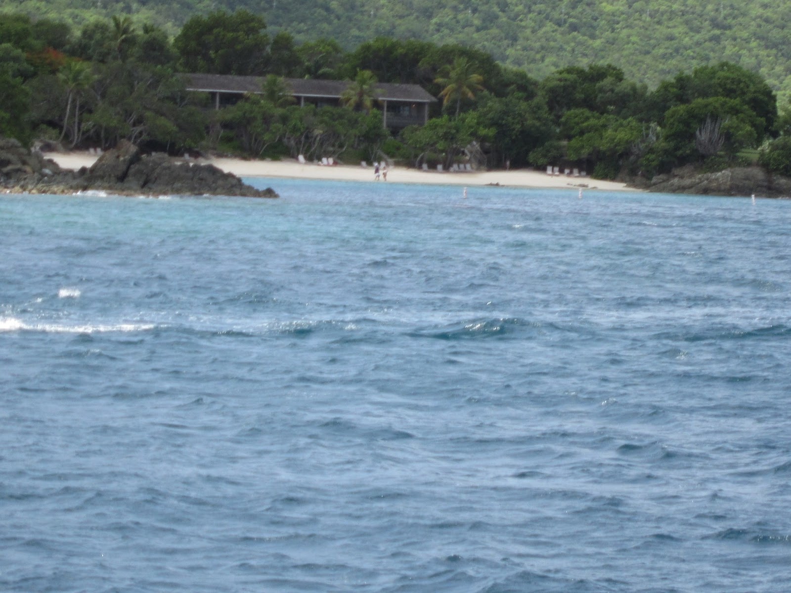
Peter Bay, St. John with Victor Hall, a childhood friend. Now Peter Bay is the home to some VERY expensive villas which you too can rent for anywhere from $1000 a night to $32,000 a week. Care to take a look? Click HERE.
As it looks today with some of the multi-million dollar homes.

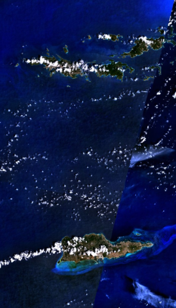
Pillsbury Sound with cruise ship. It is a three mile stretch of water that separates St. Thomas and St. John. Here the Atlantic Ocean and the Caribbean Sea mix and blend. St. Thomas is in the left background. To the right, Mingo Cay and Grass Cay. The small rocks are the Brothers. In the foreground, The Creek, St. John and Lind Point.

Paradise Point, St. Thomas: it faces south and overlooks Cowpet Bay.
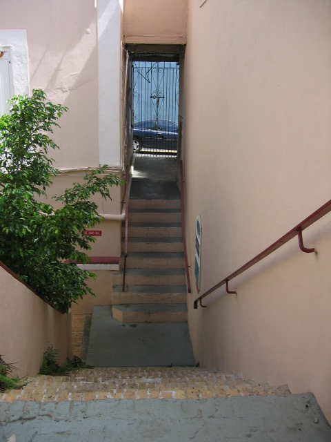
Palm Passage
One of the many alley ways that link Main Street to the Waterfront in downtown St. Thomas 

The Pissarro Building, St. Thomas. 
Birth place and family home of Camille Pissarro, father of French Impressionism. 

These windows open onto an art gallery within the Pissarro Building. 

It is warren-like and has many stairways connecting the different rooms. It is easy to imagine a young Camille running up and down the them, playing chase with his siblings.